Example of the satellite-retrieved rain rate for a scene from March 24, 2017 03:00 UTC. (b) Validation results for the developed method for satellite-based rainfall retrieval in Iran for the period February 2017 to February 2018. © Laboratory for Climatology and Remote Sensing, Philipps-Universität Marburg")
High-resolution precipitation information in near real time is crucial for water management in semi-arid regions. Second-generation GEO systems are combined with the GPM IMERG precipitation product to generate regional precipitation information in high spatio-temporal resolution.
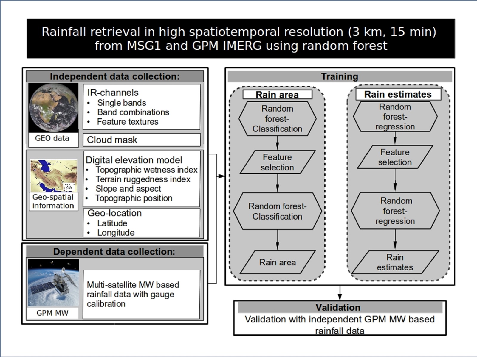
Precise high-resolution precipitation information in near real time is crucial for sustainable water management in semi-arid regions. This demand, however, contrasts with a decline of in-situ measurement equipment in meteorological networks worldwide. In this context, satellite-based precipitation products provide comprehensive precipitation information to overcome the limitations of the sparse observation network. Here, the created product combines the advantages of the second-generation GEO systems and the new GPM IMERG precipitation product using machine learning algorithms in order to generate regionally adapted precipitation information with a high spatio-temporal resolution.
The algorithm is based on the infrared bands of the GEO satellites. Random forest models were created with microwave-based GPM IMERG precipitation data as a reference in order to (i) delimit the precipitation area and (ii) estimate the rainfall rate. The method was validated with independent, microwave-based GPM IMERG precipitation data that was not used for model training. The validation results show the promising potential of the new satellite-based precipitation estimate. The algorithm was adapted for the GEO systems over the respective research regions in the SaWaM project (Iran, Brazil, Ecuador, Sudan and West Africa) and provides input for hydrological models in the research areas.