The efficient use of scarce water resources is essential to sustainable agriculture. Global maps of actual agricultural water use efficiency can serve as a foundation for environmental and economic decisions in the agricultural sector.
How do we ensure the supply of water-intensive goods like food to a growing world population in the future, despite limited water resources?
Given that the agricultural sector is the world’s largest consumer of water, there is an urgent need for highly efficient water use. The ViWA project’s high-resolution approach enables the evaluation of water use efficiency in the agricultural sector.
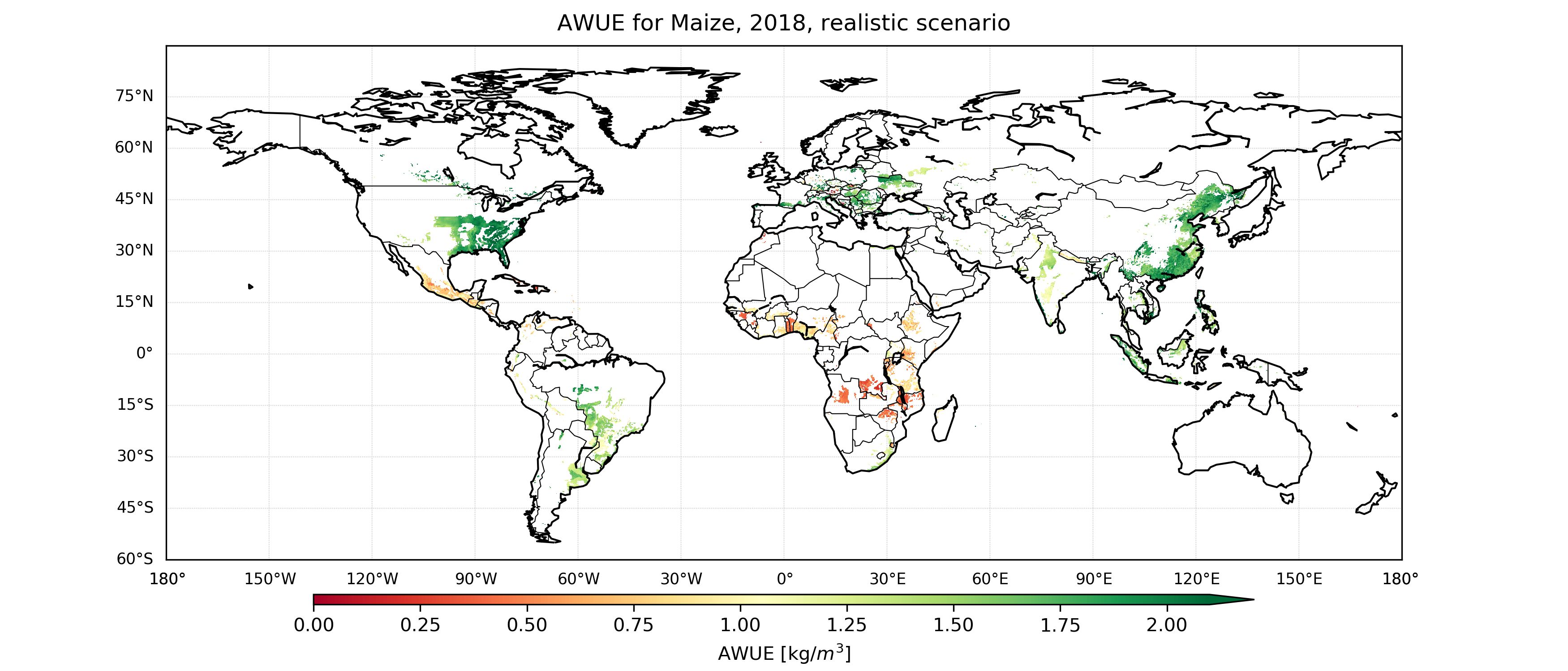
Water use efficiency in this case is defined as the ratio of agricultural yield to the amount of water used (evaporated water); in principle, it can be increased by increasing yield. However, the higher the initial water use efficiency, the lower the expected improvement with increasing yield.
The global maps allow users to identify areas with low (or high) agricultural water use efficiency. In this way, the maps can serve as a basis for decision-making as to whether and to what extent an increase in yield through optimised agricultural management should be supported and promoted from an economic and ecological perspective.
The water use efficiency maps are available on demand at a resolution of 30 arc-seconds for major agricultural crops (barley, cassava, cotton, maize, millet, potato, canola, rice, rye, sorghum, soybean, sugar beet, sugarcane, sunflower, and wheat) for the years 2015 to 2018.

