Knowledge about drainage routes during heavy rainfall events is usually held by local residents and is passed down through generations. The citizen science smart app called FloReST aims to make this knowledge accessible to authorities and research institutions.
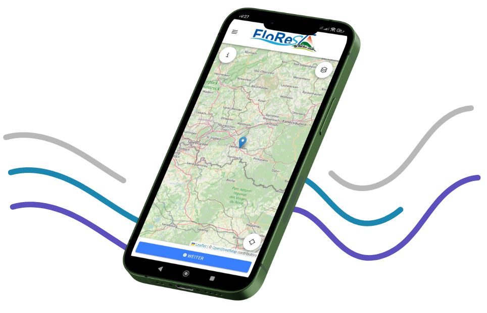
Use of the Smart App in FloReST
Extreme weather events such as heavy rainfall and urban flash floods are on the rise in Germany, posing major challenges for cities and municipalities. The BMBF project FloReST developed a citizen science app to actively involve the population in heavy rainfall prevention. Citizens record critical points—i.e., particularly sensitive or repeatedly affected locations—and document their experiences with past heavy rainfall events. This hard-to-access knowledge is incorporated into digital maps and planning processes to better assess flood risks. The aim is to systematically harness local knowledge and improve risk communication.
How can citizens participate in the research?
Note: The FloReST project has now ended and is no longer accepting new participants. With the help of the FloReST app, citizens can report observations on the consequences of heavy rainfall, such as bottlenecks or damaged infrastructure. They supplement their reports with photos and location data. All they need is a smartphone with internet access. The app is easy to use, so anyone who is interested can participate; no technical knowledge is required. The data currently collected in the demo version is used exclusively for research purposes and is not forwarded to the relevant authorities.
What happens with the results?
The data collected via the app is integrated into a geodata warehouse and linked to other information, such as hazard maps. This is done during the project period/test phase using a software solution from Disy Informationssysteme GmbH. In the future, municipalities and specialist agencies will be able to use this data for their planning purposes. Within the scope of the project, this was done for the pilot municipalities of Trier, Altenahr, Linz am Rhein, Herrstein/Rhaunen, and Mendig. In addition, the results will be prepared for scientific publications, lectures, and workshops. App users currently only receive feedback about the receipt of the report in the geodata warehouse.
How does the research contribute?
The research contributes to climate adaptation and risk communication by systematically recording local observations. The participatory survey raises awareness of heavy rain hazards and promotes self-prevention. Municipalities receive improved decision-making bases for preventive measures. The project thus contributes to increasing resilience to extreme weather events.