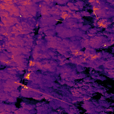
Drone-based thermal imaging enables the detection of localized changes in water surface temperature - an indicator of groundwater exfiltration into the surface stream. The raw data is calibrated using a specialized R script and subsequently orthorectified with Pix4D. This workflow allows for the rapid mapping of entire river sections with a centimeter-level resolution.
With advancing technology, drone-based remote sensing is increasingly popular in environmental sciences. While a staple in many disciplines, drone applications are not yet widely used in hydrology. This workflow outlines a best-practice approach to process raw data into orthorectified mapping products.
Infrared drones are typically equipped with a standard RGB camera and thermal infrared (IR) sensors, and less frequently with multispectral sensors (MSP). Adhering to basic guidelines ensures high-quality raw footage. Key practices include:
- Using pre-programmed routes with high overlap between frames.
- Pointing the camera straight downward (nadir) to minimize angular distortions.
- Flying in stable weather conditions (no precipitation or strong wind gusts).
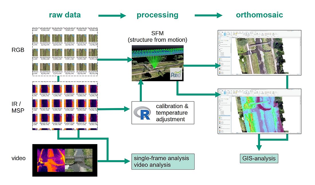
Most commercial IR-drones output JPEG images in pseudo-colours rather than temperature raster data. This limitation is resolved by a R script that converts pixel colours into temperature values and corrects for atmospheric effects (Nelson & Kattenborn, 2024).
Subsequently, a Structure from Motion (SfM) algorithm (via Pix4D software) orthorectifies both the RGB and thermal data. The software leverages frame overlap to generate an orthomosaic - a single, georeferenced, orthorectified image spanning the study area. This dual-layer product simplifies comparative analysis and feature detection.
Current drone technology makes it feasible to map groundwater exfiltration sites along river reaches within a single day. While spatial accuracy (±2 cm) easily meets most requirements, thermal data uncertainty remains relatively high (±2 °C). Under these constraints, the workflow is ideal for exploratory surveys and capturing comprehensive spatial overviews, enabling targeted, in-depth research.