Intuitive, efficient, compliant with regulations. With the Web-based RiskPlus software tool, you can easily implement the requirements of the Drinking Water Ordinance and the Drinking Water Catchment Areas Ordinance.
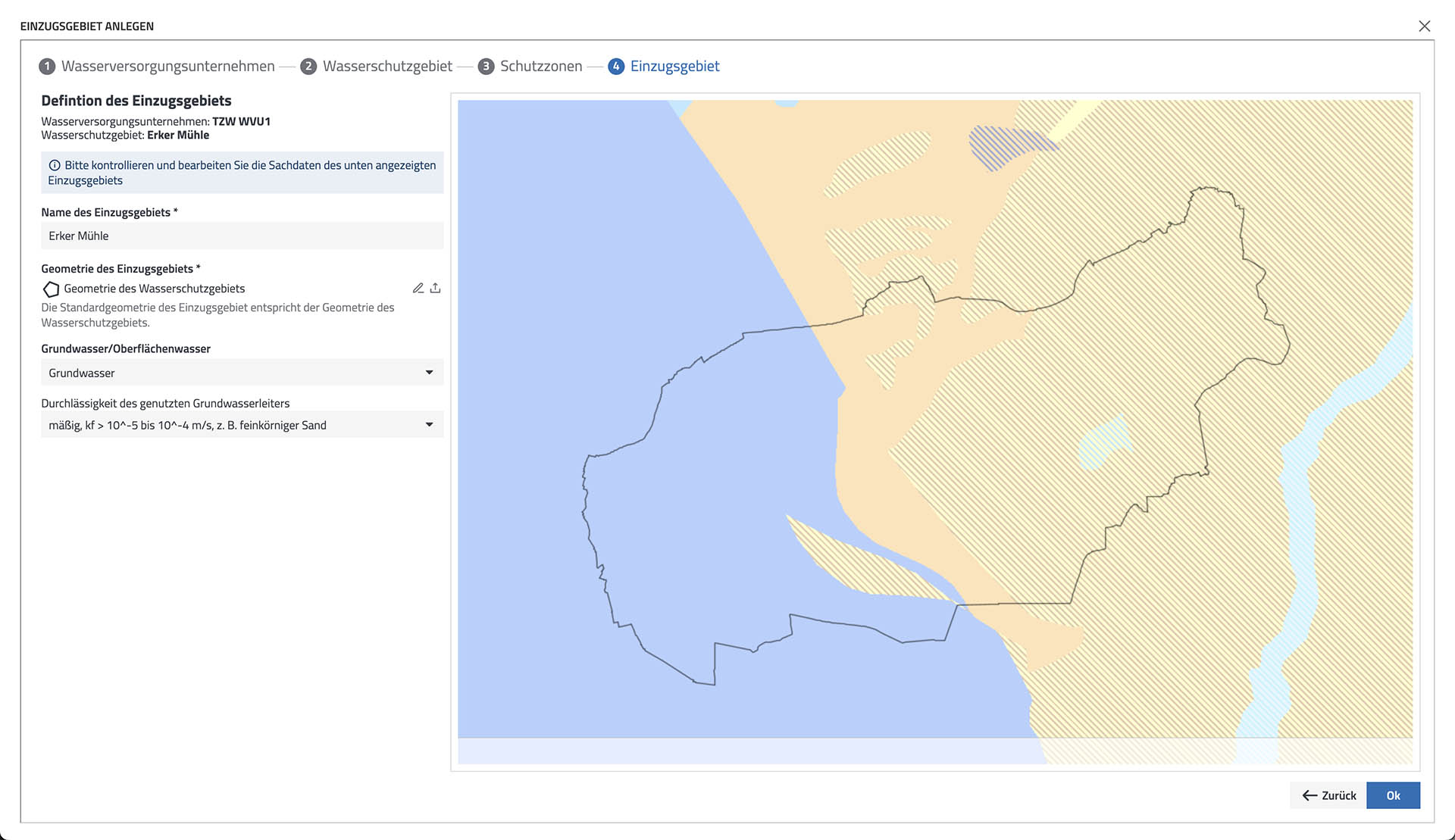
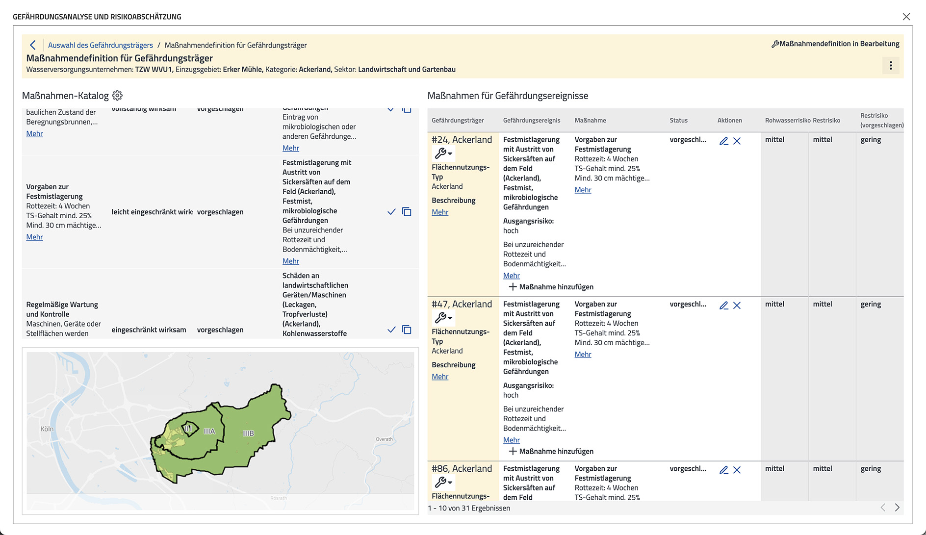
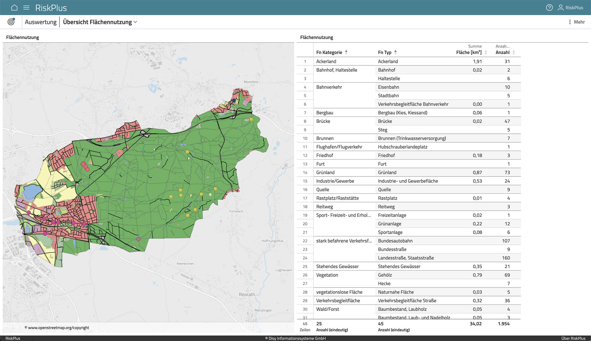
RiskPlus is a web-based software solution for water supply companies that enables the realization of a complete risk management system - from the catchment area to delivery to the consumer. RiskPlus offers all the necessary elements to meet the risk management requirements of the Drinking Water Ordinance (TrinkwV) and Drinking Water Catchment Area Ordinance (TrinkwEGV). The integration of a WebGIS provides helpful functionalities with which events and risks can be mapped and evaluated geographically. To make the procedure even easier for water suppliers, the software solution already contains basic data for risk carriers as well as suggestions for potential hazards and measures.
The advantages of RiskPlus:
- Web-based software solution for time-saving risk management in water supply and electronic documentation.
- RiskPlus supports efficient risk assessment with extensive suggestion lists and automated working steps.
- RiskPlus contains a WebGIS for spatial evaluations and visualizations in the drinking water catchment area.
- Import options for geodata and for analysis data from widespread laboratory information systems support comprehensive data integration.
- RiskPlus is compliant with regulations and meets the legal requirements for risk management in accordance with TrinkwV and TrinkwEGV, the German implementations of the European drinking water directive.
- The RiskPlus approach is based on many years of experience in drinking-water risk management and is continuously developed further.
- Many basic data are already included: Land use, water protection areas, protective effect of the catchment area and more.
- Easy collaboration with service providers (engineering offices, plant managers).
- Operation in a certified data center that implements security and compliance functions in accordance with relevant ISO standards and C5 and that guarantees a high level of data security. Data is stored and processed exclusively within the European Economic Area.