Numerical groundwater model to predict water availability

#karst aquifers #drinking water supply #groundwater recharge #vadose zone #climate change
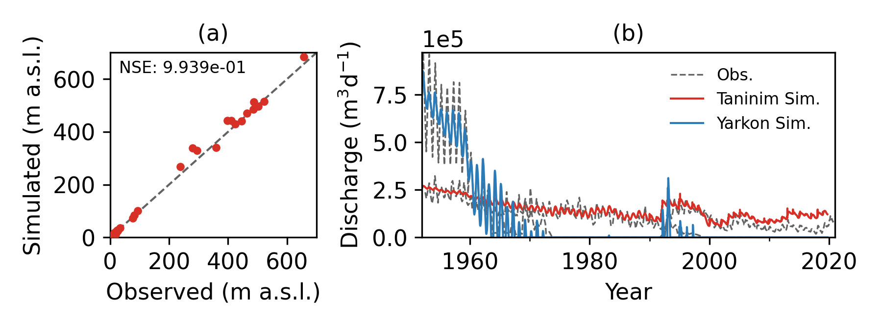
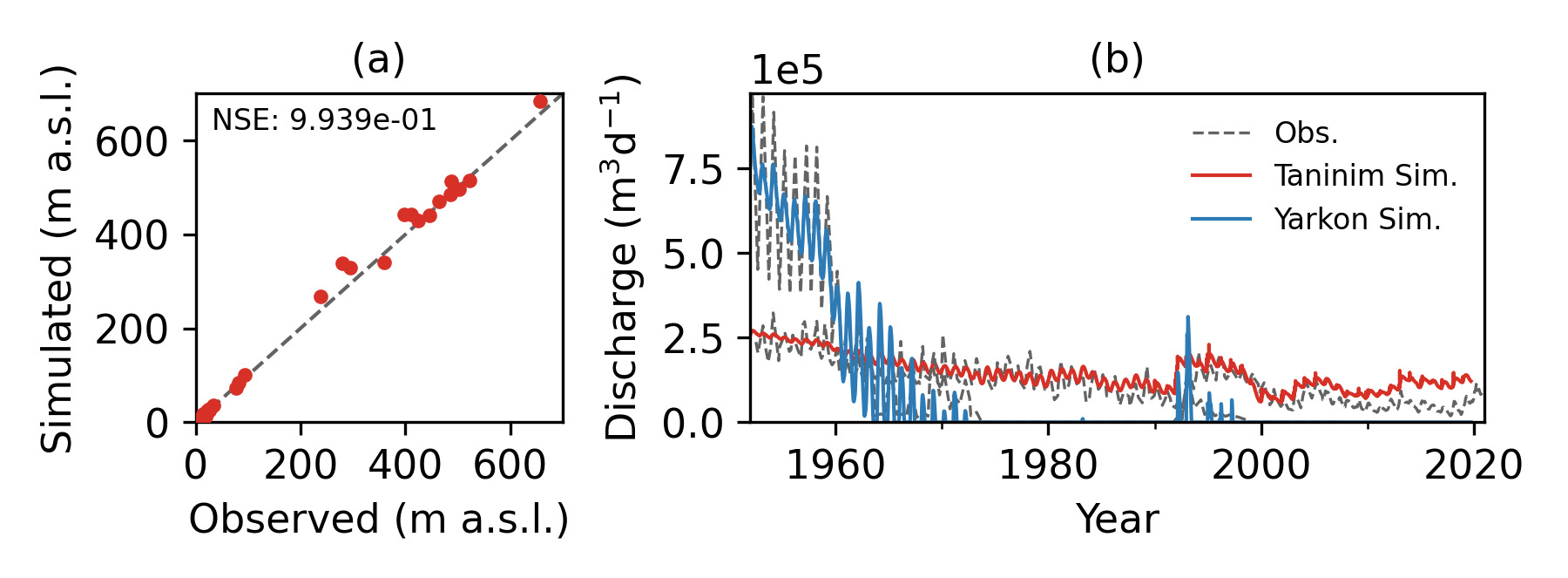
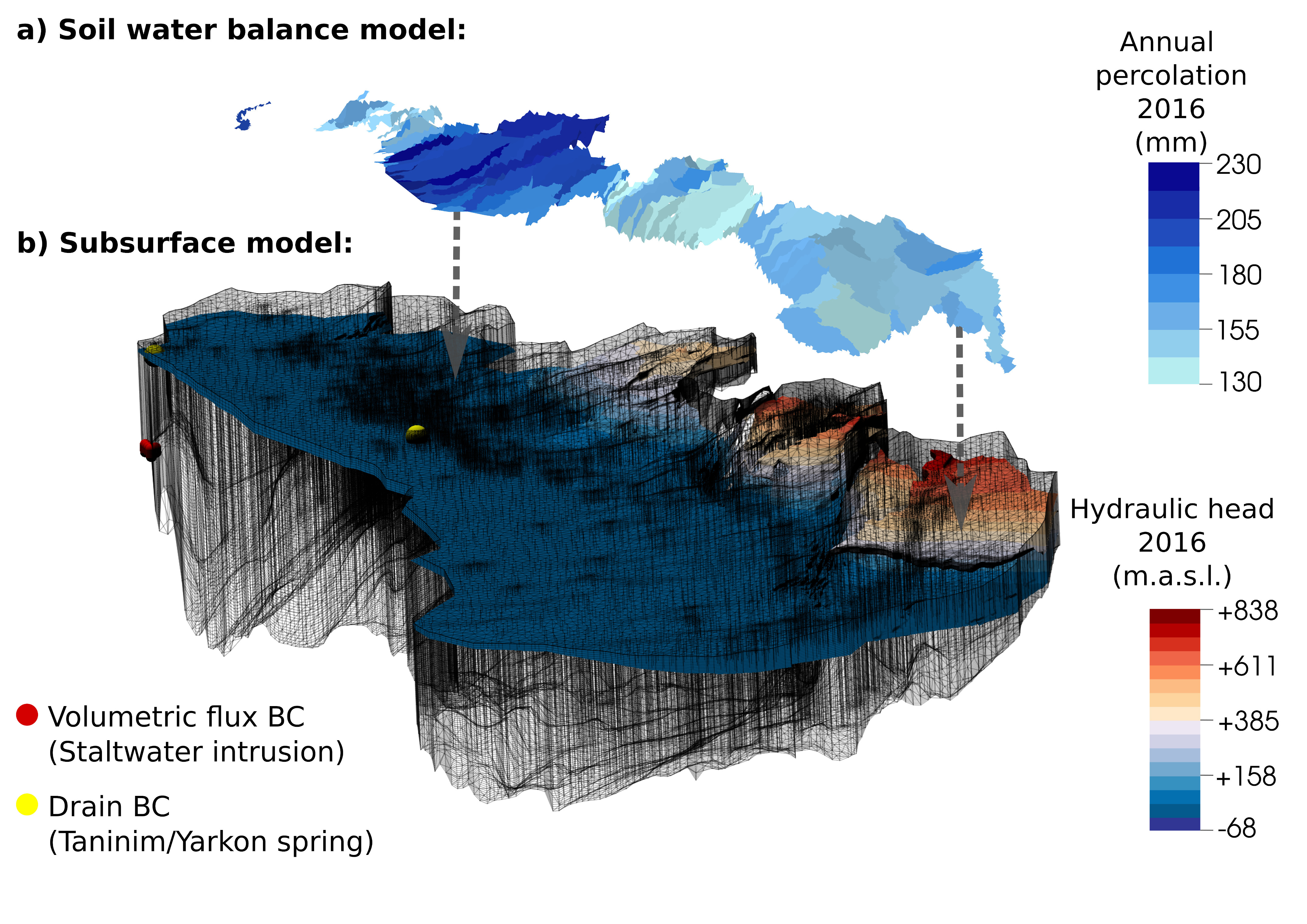
Spatial discretization and simulation results of the numerical flow model for 2016.
Spatial discretization and simulation results of the numerical flow model for 2016. © Lysander Bresinsky

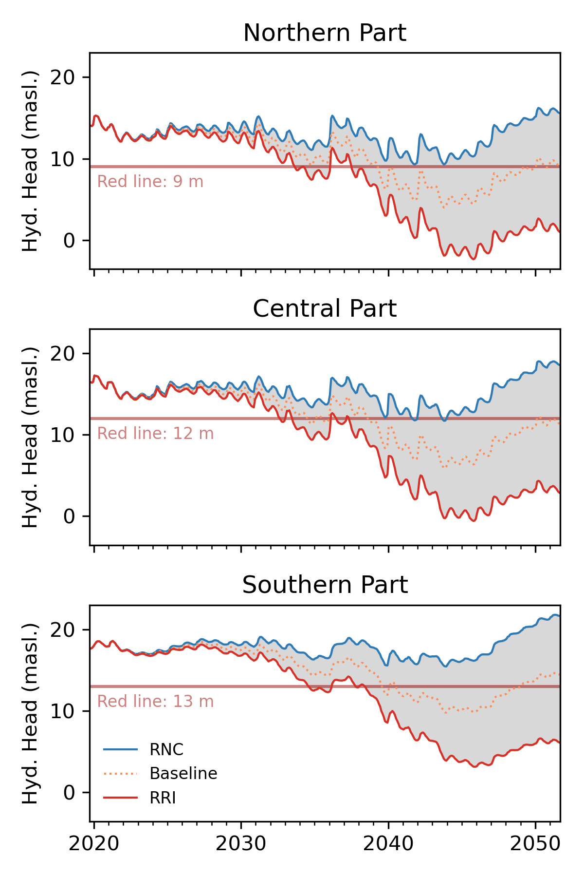
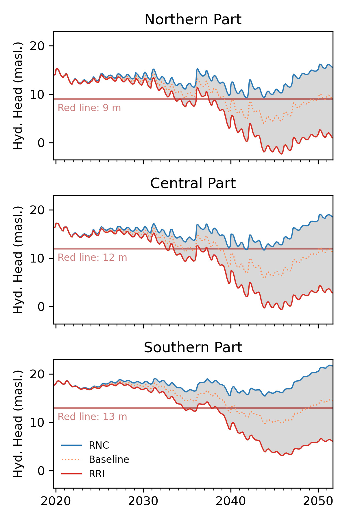
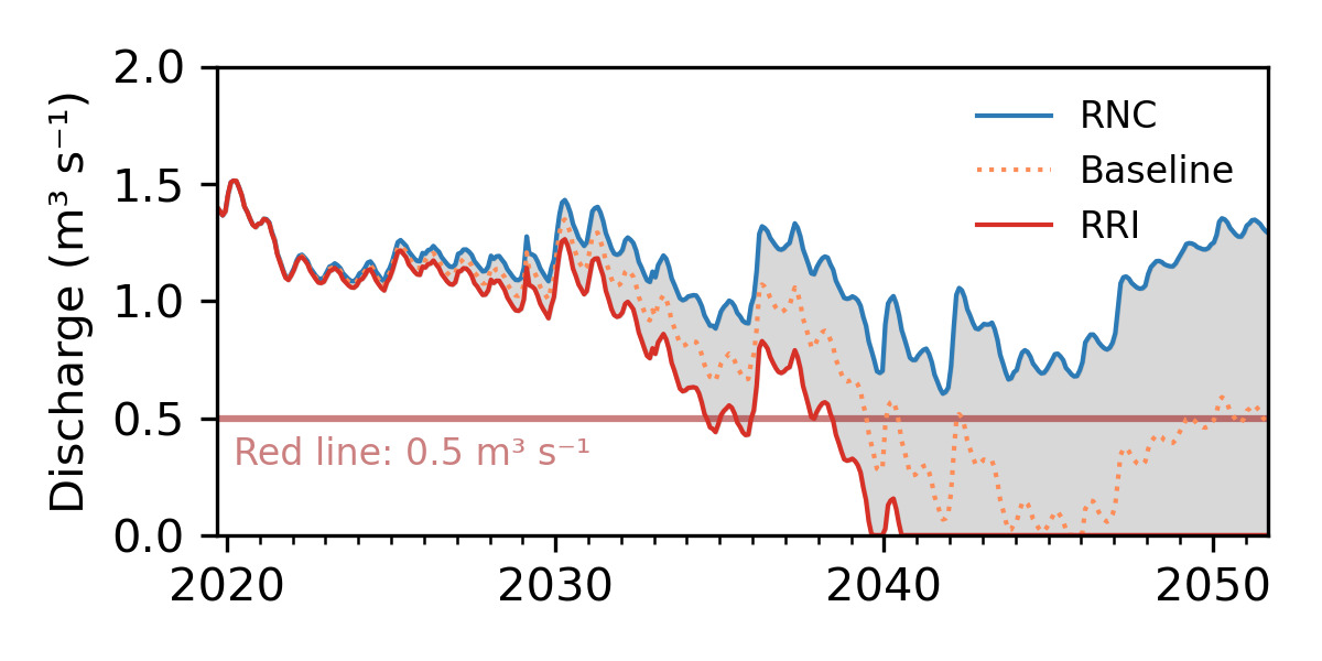
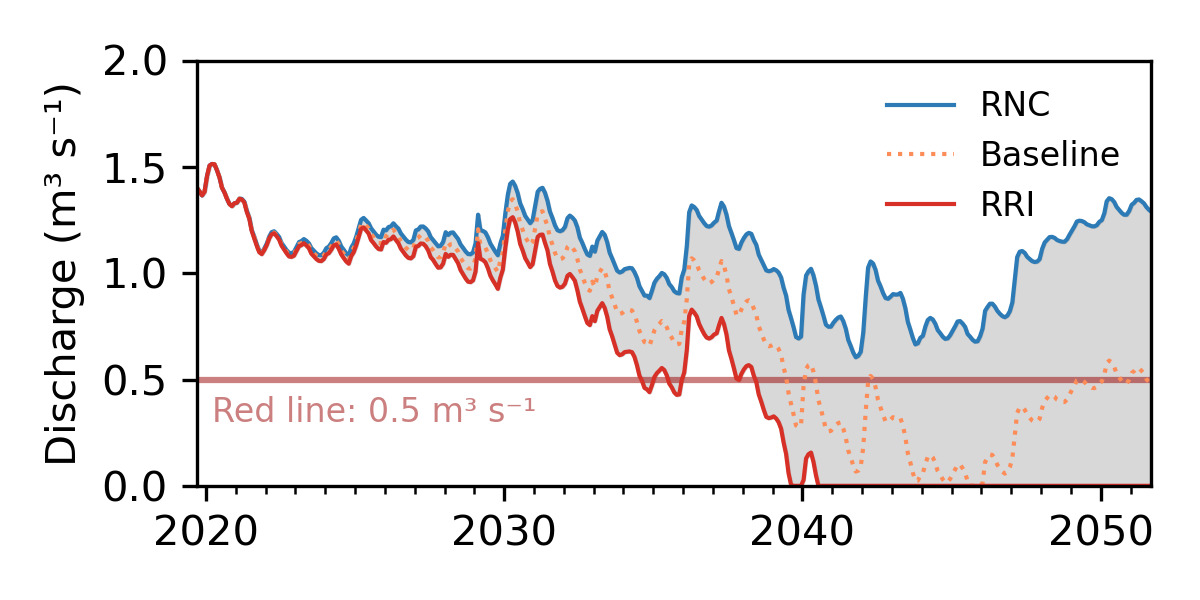
The developed numerical model of the Western Mountain Aquifer makes it possible to record the infiltration and groundwater movement under changed climatic conditions in a process-based manner. This enables the adaptation of management strategies to climatic conditions.

The numerical groundwater model has clear advantages over existing models in terms of the level of detail of the modelled processes and the spatial information density. In this way, it significantly increases the ability to predict the spatial-temporal distribution of the groundwater flow. Existing models of the Western Mountain Aquifer in Israel and the West Bank are based on spatially and temporally aggregated calculations of the new groundwater formation (in monthly and seasonal steps) and neglect the highly non-linear dynamics of the infiltration. This is described in our model with a method that includes the slow, diffuse and the fast, focused neoplasm component. The storage and delay effect of the unsaturated zone, which is several hundred meters thick, is taken into account by applying the double continuum model. It allows the integration of the near-surface groundwater recharge in daily resolution and the calculation of the infiltration over the matrix and karst tube continuum.

The process-based, distributive simulation of new formation events enables local authorities to carry out a large number of additional studies in order to develop management strategies adapted to climate change. Predictive model studies allow, for example, the optimal location determination for groundwater recharge (“Managed Aquifer Recharge”) and the recording of the storage capacity of the aquifer.

Water resource: Drinking water, Groundwater, Surface water
Type of product:
  • Modelling & software tools
TRL: 6
    TRL (Technology Readiness Level)
  • TRL 1 - Basic principles observed
  • TRL 2 - Technology concept formulated
  • TRL 3 - Experimental proof of concept
  • TRL 4 - Technology validated in lab
  • TRL 5 - Technology validated in relevant environment (industrially relevant environment in the case of key enabling technologies)
  • TRL 6 - Technology demonstrated in relevant environment (industrially relevant environment in the case of key enabling technologies)
  • TRL 7 - System prototype demonstration in operational environment
  • TRL 8 - System complete and qualified
  • TRL 9 - Actual system proven in operational environment (competitive manufacturing in the case of key enabling technologies; or in space)
Application sector: Agriculture, Cities and municipalities, Industry, Natural water environment, Water resource management
Funding measure: GRoW
Project: MedWater

Contact and partners


Logo Georg-Augustin-Universität Göttingen, Department of Applied Geology
  • Georg-Augustin-Universität Göttingen, Department of Applied Geology,
  • Goldschmidtstraße 3,
  • 37077 Göttingen
https://www.uni-goettingen.de/de/8483.html

Georg-Augustin-Universität Göttingen, Department of Applied Geology,
Göttingen

Media library


This site uses third-party website tracking technologies to provide its services. I agree to this and can revoke or change my consent at any time with effect for the future.

Settings Decline AcceptLegal NoticePrivacy Policy