With the inclusion of high-resolution geo- and meteorological data, the WASA-SED system (developed for semi-arid regions) enables the comprehensive quantification of hydrological and sedimentological parameters on the hydrological mesoscale (up to several 100,000 km2) for basins and reservoirs.
Semi-arid regions are critical in terms of water availability and water management. A distinctive seasonality of the natural water availability is characteristic of the hydro systems of these areas. As a result, water shortage is a predominant problem, both on a time scale (e.g. seasonal dry periods; drought years) and on a spatial scale (e.g. local hotspots; insufficient water infrastructure).
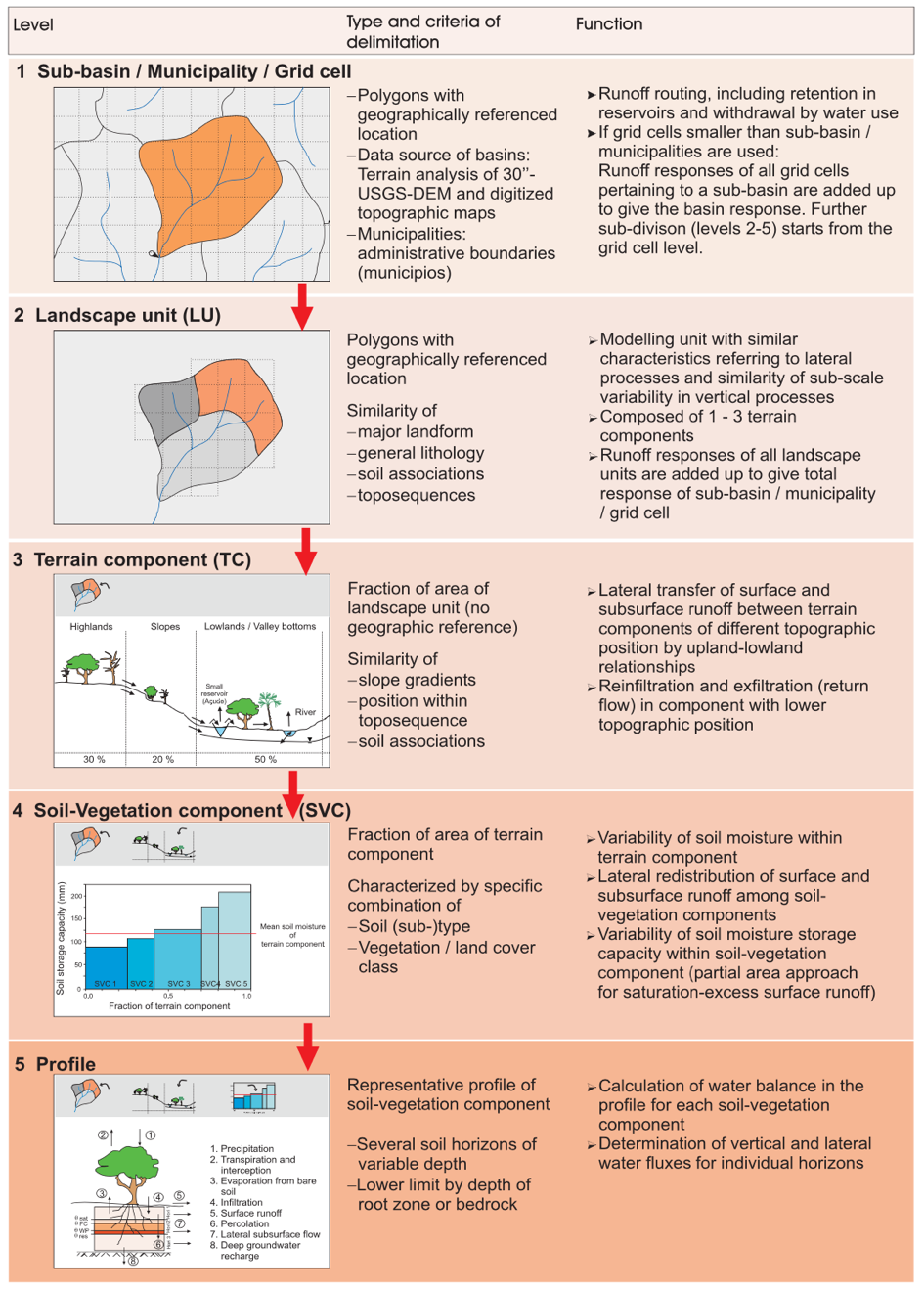
In recent years, the hydro-sedimentological model system “WASA-SED” (Water Availability in Semi-arid Areas with Sediment Dynamics), which is oriented towards semi-arid conditions, has been (further) developed. WASA-SED includes process-oriented approaches for hydrological and erosion processes with special attention to semi-arid conditions. Due to the multi-scale approach, WASA-SED can treat areas between a few hectares and several 100,000 km2.
With the inclusion of high-resolution geo- and meteorological data, WASA-SED can model and quantify hydrological and sedimentological parameters on time and spatial scales relevant for water management, both for basins and reservoirs. The further developments implemented by WASA-SED also enable the inclusion of snow, irrigation systems and globally available soil data in the modelling. New information about seasonal hydro-meteorological conditions or changes in land use can in this way be “processed” with WASA-SED, which enables the quantification of the effects of water and sediment dynamics on regional hydrological processes, storage processes and the security of water supplies.

