Back to the list

GW 4.0: Real-Time Planning Tool for Groundwater Management

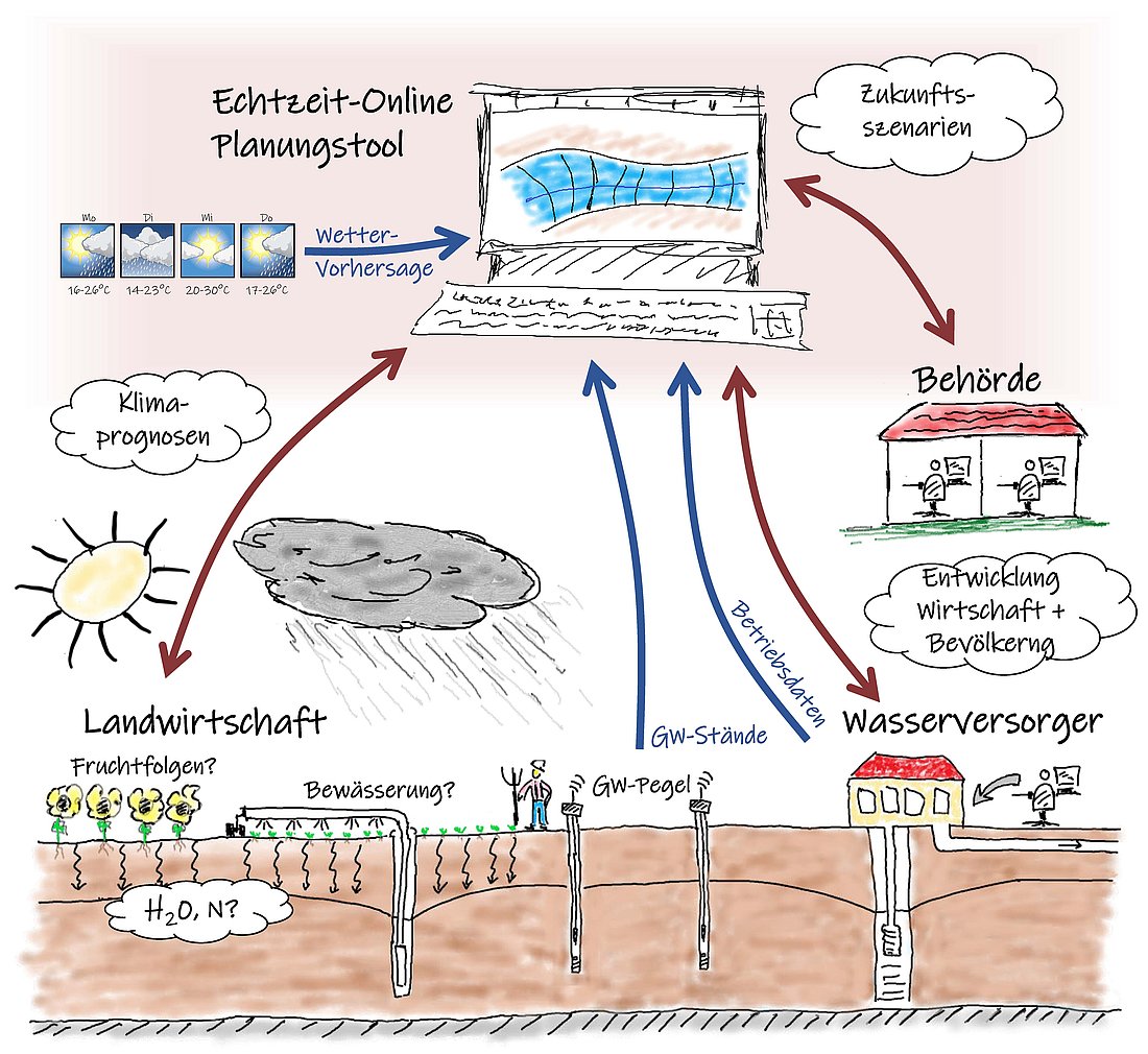
Schematische Zeichnung: Ein Computerbildschirm mit einem Grundwasserleiter-Querschnitt in der Mitte steht für das Echtzeit-Online-Planungstool. Im linken Bereich wird der Einfluss von Wettervorhersagen und -prognosen (Sonne, Wolke, Klimaprognosen-Sprechblase) symbolisiert sowie die Landwirtschaft (Feld mit Pflanzen, Bewässerung, Grundwasserpegeln und einer Denkblase "H2O, N?"). Im rechten Bereich ist eine Behörde (Gebäude mit zwei Personen am Computer) mit einer Denkblase "Entwicklung Wirtschaft + Bevölkerung" sowie ein Wasserversorger (Gebäude mit Förderbrunnen) dargestellt. Rote Pfeile verbinden Landwirtschaft, Behörde und Wasserversorger bidirektional mit dem Planungstool, blaue Pfeile zeigen Betriebsdaten und Grundwasserstände, die vom Wasserversorger und den Pegeln zum Tool fließen. Oben rechts symbolisiert eine Wolke "Zukunftsszenarien".
Eigene Darstellung, Universität Tübingen (Olaf A. Cirpka): Schema der Verknüpfung aller Informationen und Berechnungen im online Informations- und Planungsinstrument und für die Prognosen relevante Einflussfaktoren bezgl. Klima, Landnutzung, Wirtschafts- und Bevölkerungsentwicklung; rote Pfeile stehen für "Was-wäre-wenn"-Anfragen der Akteure (Landwirtschaft, Wasserversorger, Behörden) an das Tool über die Internet-Schnittstelle; die Wolken symbolisieren Einflussfaktoren (Klima, Landnutzung, Wirtschafts- und Bevölkerungsentwicklung) und Zielgrößen (Grundwasserdargebot, Nitrat) der Zukunftsszenarien.

GW 4.0 is a web-based real-time planning tool for water suppliers and authorities that computes groundwater recharge and groundwater levels for current conditions and future scenarios. It supports climate-adapted, sustainable management of groundwater resources in agricultural regions.

Since 2003, southern Germany has experienced declining annual precipitation and—since the late 1980s—a rise in mean annual temperatures; this has resulted in significantly reduced groundwater recharge, a trend expected to continue due to climate change. The irrigation requirements for many crops will increase. GW 4.0 addresses these challenges with a web-based information and planning tool that provides water suppliers and authorities—for the first time—with a user-friendly, scientifically sound, real-time instrument for both operational and long-term decision-making.

The tool integrates several simulation models: the soil water balance model GWN-BW calculates spatially and temporally differentiated groundwater recharge rates; the agro-ecosystem model Expert-N simulates dynamic crop growth, irrigation needs, and nitrogen turnover; and a groundwater flow model represents the three aquifers in use (Neckar gravels, Erfurt Formation, and Upper Muschelkalk). Through data assimilation, the coupled water balance model is continuously updated with current groundwater and weather data.

For the first time, GW 4.0 makes the complex interactions between land management, climate, and groundwater dynamics actionable for practical use and provides a concept that can be transferred to other regions.

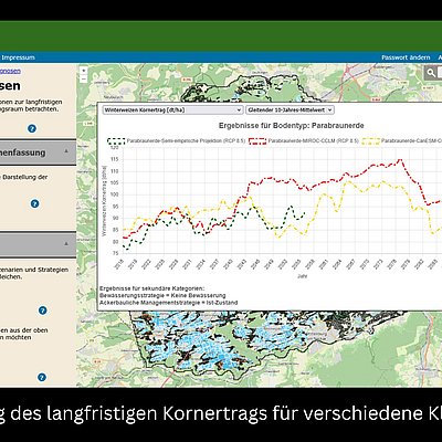
An innovative feature is the integration of short- and long-term perspectives within a single platform: users receive automatically generated seasonal forecasts regarding groundwater recharge and levels based on DWD-EPISODES weather data. Water suppliers  have the ability to run their own "what-if" scenarios concerning management practices (e.g. well failure or changed remote water supply usage ) via the web interface. In addition, GW 4.0 provides long-term projections of the groundwater system's evolution up to 2100 based on climate projections, enabling an assessment of the long-term viability of existing infrastructure and potential adaptation strategies.


Water resource: Drinking water, Groundwater
Type of product:
  • Management concepts & assessments
  • Modelling & software tools
Application sector: Agriculture, Cities and municipalities
Funding measure: LURCH
Project: GW_4.0

Contact and partners


Logo Ingenieurgesellschaft Prof. Kobus und Partner GmbH
  • Ingenieurgesellschaft Prof. Kobus und Partner GmbH,
  • Wilhelm-Haas-Str. 6,
  • 70771 Leinfelden-Echterdingen (Oberaichen)
https://www.kobus-partner.com
Alexander Kissinger
  • +49 711 400928 0

Universität Tübingen, Geo- und Umweltforschungszentrum,
Tübingen
Universität Hohenheim, Fachgebiet Biogeophysik
Landesanstalt für Umwelt Baden-Württemberg (LUBW)
Landwirtschaftliches Technologiezentrum Augustenberg (LTZ)
GIT HydroS Consult GmbH
Zweckverband Ammertal-Schönbuchgruppe (ASG)

Media library