© GlobeWQ")
The GlobeWQ platform provides access to global and selected regional water quality information, linking water quality data from satellite imagery, in-situ observations, and model results.
The GlobeWQ project has developed a prototype web-based platform that provides access to global and selected regional water quality information.
The platform combines data from in situ observations, satellite-based remote sensing, and water quality modeling to provide robust and timely water quality information with improved spatial coverage.
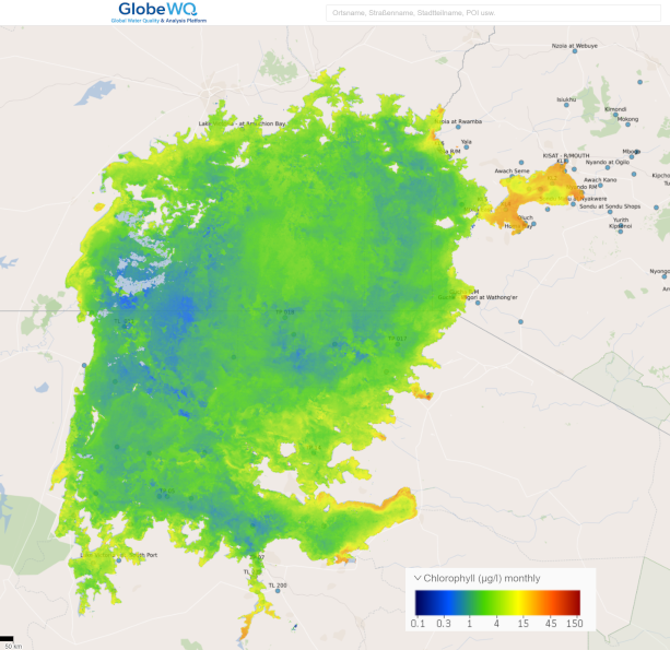
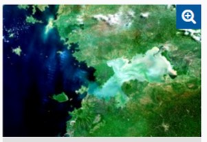
GlobeWQ provides global water quality information based on WorldQual model outputs and incorporating in situ data from the GEMStat water quality database (https://gemstat.org). The globally available information is supplemented regionally for the case studies with data products from remote sensing (EOMAP, eoWaterQuality) and additional in situ data. The regional case studies are ideally created in a co-design process so that the data products are tailored to the needs of the users. One example is Lake Victoria. Here, GlobeWQ specifically provides water quality information for Lake Victoria and its tributaries, such as Chlorophyll-a from remote sensing and phosphorus loads from tributary catchments calculated/estimated using the WorldQual model.
The GlobeWQ platform is based on open software, established standards and interfaces. GlobeWQ data products can be made available as a WebMapService if needed. This ensures interoperability with other platforms.