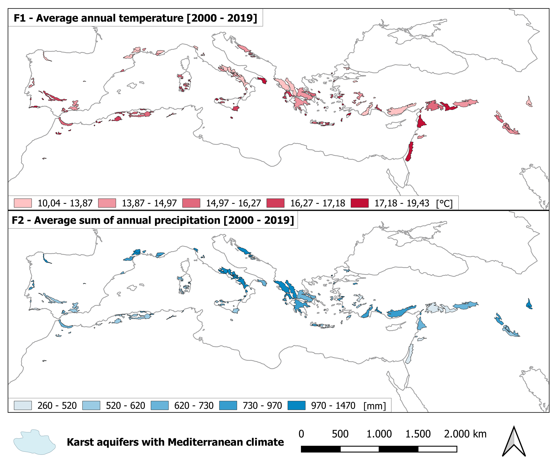
Karst aquifers are vital for water supply worldwide. To investigate the current condition of the critical groundwater resources, six hydrogeological, climatic, and ecological indicators of groundwater stress were determined as well as average annual temperature and precipitation.
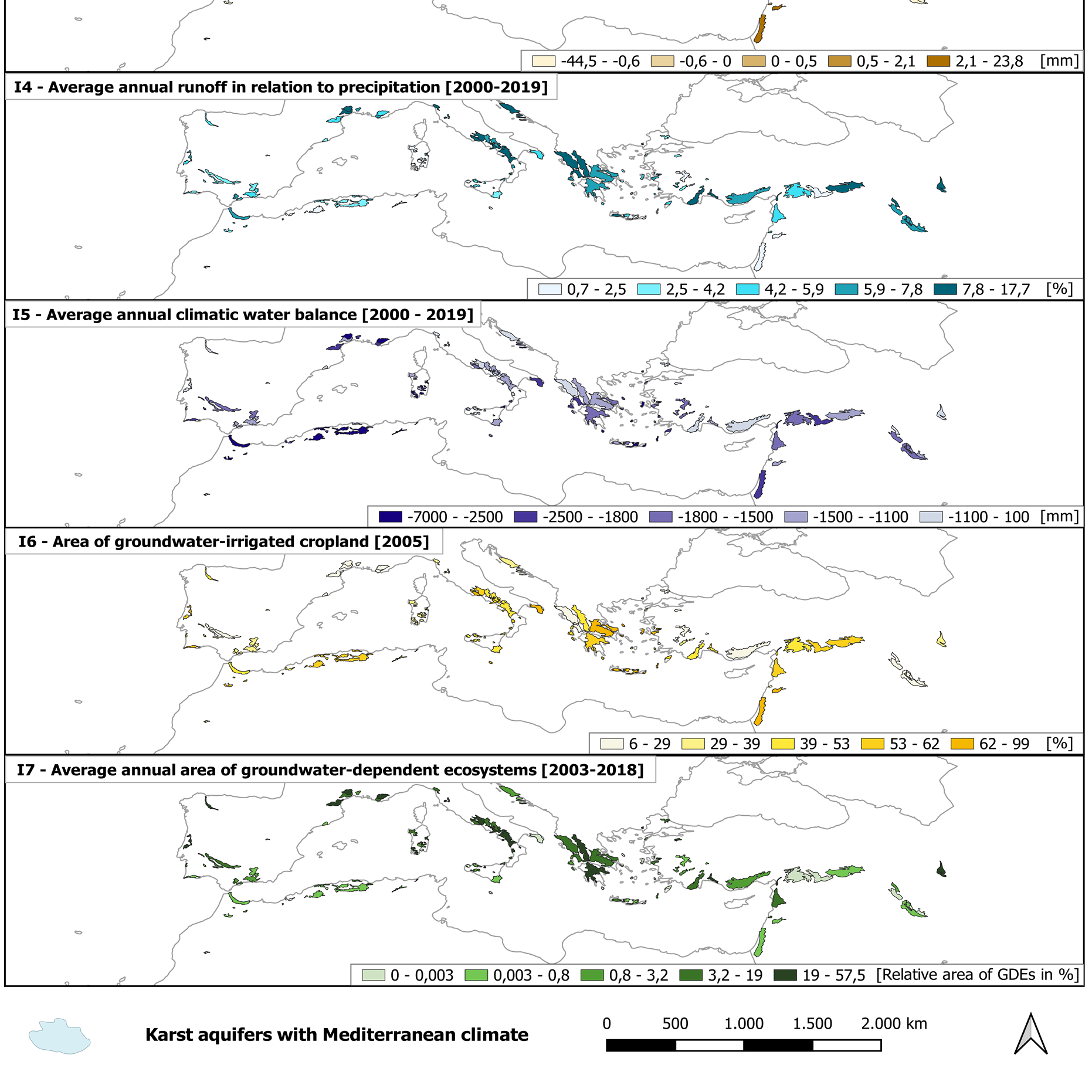
To identify karst aquifers with Mediterranean climates, the World Karst Aquifer Map (WHYMAP WOKAM) was layered with Mediterranean climate zones Csa, Csb, and Csc (Köppen/Geiger; Beck et al., 2018). To increase the detail, the aquifers were subdivided using boundaries from the HydroBASINS-database. Six indicators for the hydrogeological, climatic and ecological conditions of an aquifer were defined:
- Groundwater recharge
- Groundwater abstractions
- Runoff in relation to precipitation
- Climatic water balance
- Groundwater-irrigated cropland
- Groundwater-dependent ecosystems
The indicators were provided by outputs from the global freshwater model WaterGAP (version 2.2d), calculated using ERA5-Land data and obtained from the FAO’s AQUASTAT dataset “Global Map of Irrigation Areas” (latest version 5.0). MODIS NDVI (MOD13Q1) data was utilized in groundwater-dependent ecosystems to identify areas that remain relatively “green” during dry periods as an indicator of vegetation with access to groundwater. The resulting maps of the Mediterranean region are included.
The project shows that high annual temperatures and low annual precipitation (based on ERA5-Land data) seem to be driving factors for a negative climatic water balance and decreased groundwater recharge. Groundwater abstractions and relative areas of groundwater-irrigated cropland decline with lower water availability. Together, the six indicators provide an initial estimation of quantitative groundwater stress. However, while global analyses show hotspots and emerging trends, optimal groundwater management remains site-specific and requires sophisticated modeling tools that rely on abundant input data to forecast future resource availability.


