The 52°North Sensor Web Suite offers a comprehensive solution for integrating sensor data in research data infrastructures. This ranges from data provision and data management to data analysis and visualisation.
Sensor measurements are becoming increasingly important in many research contexts, as they provide knowledge about the state of the environment (both current and historical) and can be used to answer scientific questions. They are also an important input for the control and operation of infrastructure elements such as dams and water reservoirs. Typical use cases are domains such as water management, hydrology, oceanography, traffic monitoring, air quality and agriculture. The 52°North Sensor Web Suite supports this need with a comprehensive solution providing server and client components for data publication, management and use.
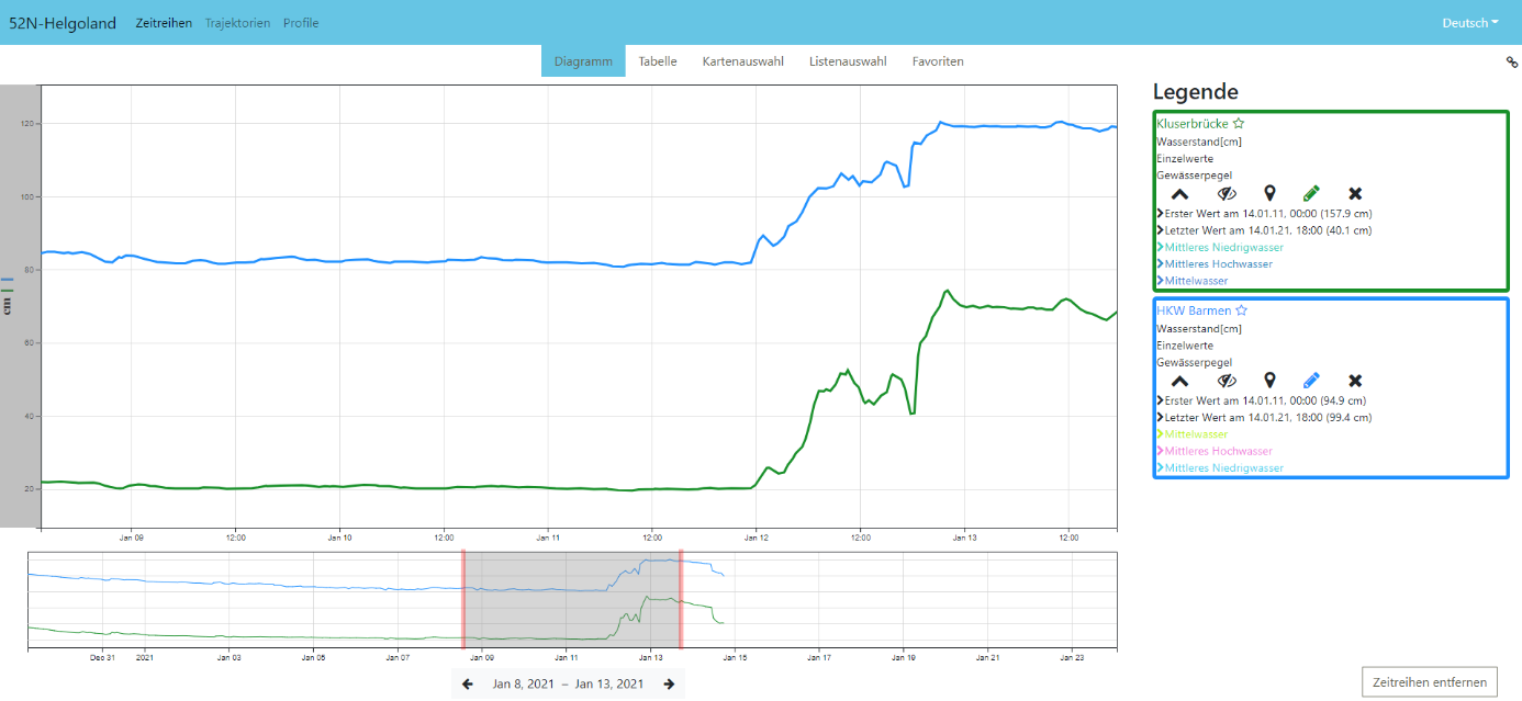
For example, the suite has components and options to connect sensors via Internet of Things standards, integrate existing databases and import file-based measurement data (e.g., CSV files). The data management includes various interface implementations (e.g. REST/JSON) for uploading, maintaining and downloading measurement data and the associated metadata (e.g. OGC SensorML). Various relational databases such as PostgreSQL, Oracle, Microsoft SQL Server or MySQL can be used to persist the data. The functionality is rounded out by client components for web-based data exploration and visualisation (Helgoland Sensor Web Viewer) as well as for simplified integration in R and Python.
In addition, the support of international standards (e.g., INSPIRE, OGC Sensor Web Enablement, SensorThings API, MQTT) ensures interoperability.


