The automated EFTAS satellite data integration provides products tailored to the field of water management. It offers the weekly, areal state in and around the water surface and can be integrated into further model and simulation calculations.
The monitoring and management of water bodies and their catchment areas requires continuous measurements that reflect the current state of the water. These measurements typically take place in-situ at regular intervals. The integration of satellite data in this process offers numerous advantages and is well suited to supplement or reduce in-situ data acquisition. The basis for the developed processes and products were primarily satellite images from the European space program Copernicus, which can be used free of charge. The focus was on the satellite data from the Sentinel-2 in particular. Sentinel-2 consists of two identical satellites that alternately fly over the same area of the earth's surface every five days and record an optical image with a ground pixel size of a maximum of 10 meters in 13 bands.
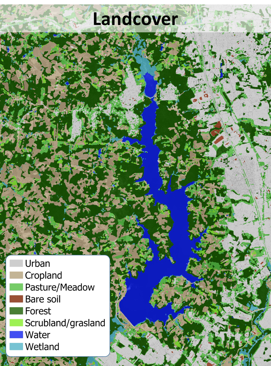
The following products, among others, resulted from the requirements with regard to issues in the area of water management: land cover classification, urban soil sealing, vegetation density, albedo, chlorophyll-a concentration, surface temperature, change in vegetation vitality.
The fact that the satellite data is available free of charge, globally and with high temporal resolution, makes the global usability of the methods even more interesting.